In today’s data-driven world, accurate location information is more important than ever. Businesses, government agencies, and service providers all rely on correct address data to operate efficiently. However, traditional address systems often struggle with inconsistencies, missing details, or formatting errors. This is where modern solutions like address matching systems come in—and even more importantly, where GIS technology plays a powerful role.
Geographic Information Systems (GIS) help transform basic address data into accurate, intelligent, and actionable location insights. By combining mapping, spatial analysis, and data integration, GIS significantly improves how address matching systems work across the UK.
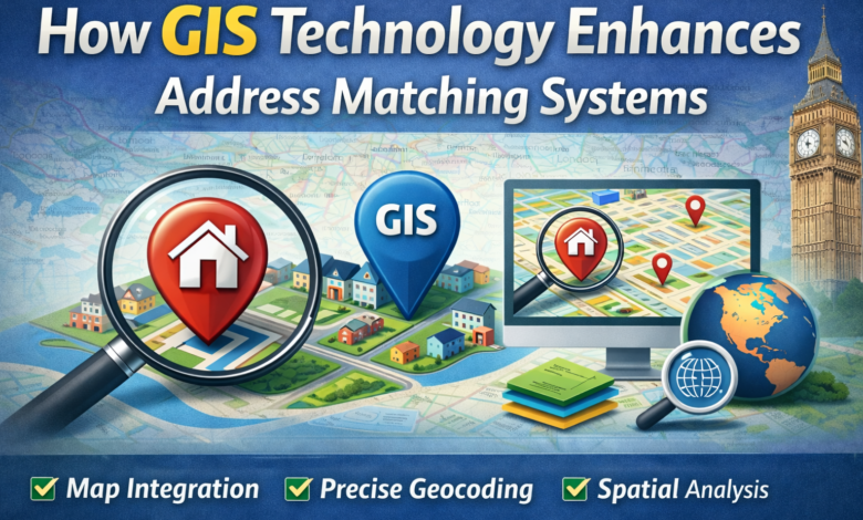
Understanding Address Matching Systems
Address matching systems are designed to compare and align address data with official records. These systems take an input—such as a customer’s address—and match it against trusted datasets to ensure it is correct and complete.
The main goal is to improve data quality by fixing errors like incorrect postcodes, spelling mistakes, or missing information. Without proper matching, businesses can face issues such as failed deliveries, duplicate records, and poor customer experiences.
However, traditional address matching relies heavily on text-based comparisons. This can be limiting, especially when addresses are entered in different formats. This is where GIS technology adds a new level of accuracy and intelligence.
What Is GIS Technology and Why It Matters
GIS, or Geographic Information Systems, is a technology used to capture, store, analyse, and display location-based data. Instead of relying only on written addresses, GIS uses geographic coordinates such as latitude and longitude to identify exact locations.
In the UK, GIS is widely used in mapping services, urban planning, and logistics. It allows organisations to visualise data on maps, making it easier to understand patterns and relationships.
When applied to address matching systems, GIS provides a spatial layer of information. This means that even if an address is slightly incorrect, the system can still identify the correct location based on its geographic position. This greatly improves accuracy and reduces errors.
Improving Location Accuracy with GIS
One of the biggest advantages of GIS technology is its ability to improve location accuracy. Traditional address matching systems depend on text, which can vary in format and spelling. GIS, on the other hand, focuses on precise geographic coordinates.
For example, if two addresses are written differently but refer to the same location, GIS can recognise them as identical by mapping their coordinates. This eliminates confusion and ensures that the correct property is identified.
In rural areas or newly developed locations, where addresses may not yet be standardised, GIS is especially useful. It allows systems to pinpoint exact locations even when address data is incomplete.
By enhancing location accuracy, GIS helps businesses avoid costly mistakes, such as sending deliveries to the wrong place or storing incorrect customer information.
Enhancing Mapping and Visualisation
Another key benefit of GIS technology is its ability to create detailed maps and visual representations of data. Address matching systems that use GIS can display locations on a map, making it easier to understand and verify address information.
Mapping allows businesses to see where their customers are located, identify service areas, and plan operations more effectively. For example, a logistics company can visualise delivery routes and optimise them for speed and efficiency.
GIS also supports layering of data. This means that different types of information—such as customer addresses, traffic conditions, or service zones—can be combined on a single map. This provides a clearer picture of how address data fits into real-world environments.
By turning raw data into visual insights, GIS makes address matching systems more practical and user-friendly.
Supporting Address Intelligence and Data Insights
GIS does more than just improve accuracy—it also adds intelligence to address data. When combined with address matching systems, GIS can provide valuable insights that go beyond basic location information.
For example, businesses can analyse customer distribution, identify high-demand areas, and plan expansions based on geographic trends. This type of analysis is often referred to as address intelligence.
GIS can also enrich address data by adding additional details, such as nearby landmarks, property types, or accessibility information. This helps organisations better understand their customers and improve service delivery.
In sectors like retail, utilities, and healthcare, this level of insight is extremely valuable. It allows businesses to make informed decisions and deliver services more effectively.
Improving Efficiency in Logistics and Services
Efficiency is a major concern for many UK businesses, especially those involved in delivery and field services. Address matching systems powered by GIS can significantly improve operational efficiency.
By using accurate location data, companies can plan better routes, reduce travel time, and minimise fuel costs. Drivers can rely on precise mapping rather than unclear or incorrect addresses, leading to fewer delays.
GIS also helps in managing large datasets. Businesses can quickly process and match thousands of addresses, ensuring that their systems remain clean and up to date.
For emergency services, accurate location data can be life-saving. GIS-enabled systems help responders find locations بسرعة and accurately, improving response times and outcomes.
Overall, the combination of GIS and address matching leads to smoother operations and better resource management.
The Future of GIS in Address Matching Systems
As technology continues to evolve, the role of GIS in address matching systems will become even more important. With the rise of smart cities, IoT devices, and advanced data analytics, accurate location data will be at the centre of innovation.
Future systems will likely combine GIS with artificial intelligence to deliver even more precise and predictive results. For example, systems may automatically detect and correct address errors before they occur or provide real-time location updates.
In the UK, the increasing availability of open geospatial data will also support wider adoption of GIS-based solutions. Businesses of all sizes will be able to access powerful tools that improve address accuracy and efficiency.
Read also: Innovative tech solutions enhancing modern security measures
Conclusion
GIS technology is transforming how address matching systems work by adding accuracy, intelligence, and visual insight. While traditional systems rely on text-based data, GIS introduces a spatial dimension that ensures precise location identification.
From improving location accuracy to enhancing mapping and supporting data-driven decisions, GIS plays a vital role in modern address management. It helps businesses reduce errors, improve efficiency, and deliver better services.
As the demand for accurate address data continues to grow, integrating GIS technology into address matching systems is no longer optional—it is essential for success in a competitive and connected world.